Engineered, built, and deployed in America

Critical Information On Demand

Voltair delivers drone inspection data in minutes not days.

Engineered, built, and deployed in America

Critical Information On Demand

Voltair delivers drone inspection data in minutes not days.

Engineered, built, and deployed in America

Critical Information On Demand

Voltair delivers drone inspection data in minutes not days.

Engineered, built, and deployed in America

Critical Information On Demand

Voltair delivers drone inspection data in minutes not days.

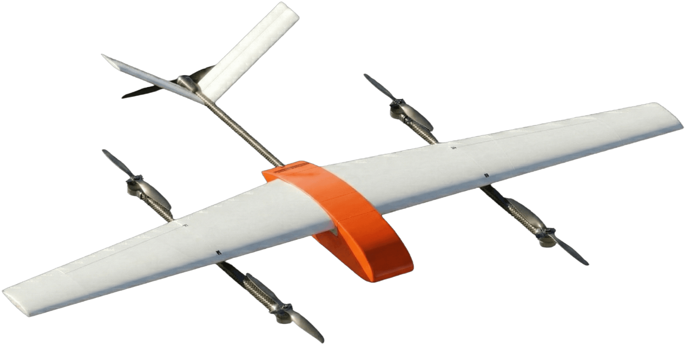
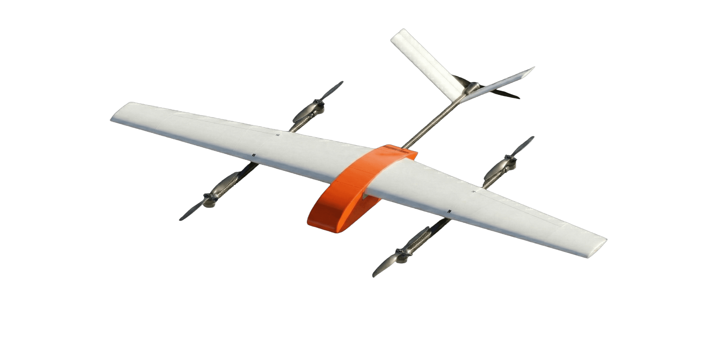
Faraday-1

Faraday-1

[01 // AIRCRAFT]

High-Resolution Visual

RGB sensors capture imagery of every asset at both the structure and component level.

Radiometric Thermal

Per-pixel temperature data reveals hotspots, failing splices, and overloaded equipment long before visible failure.

LiDAR

LiDAR captures precise 3D measurements of utility assets and vegetation for clearance analysis, digital twins, and engineering modeling.

85 mi

FLIGHT RANGE

135 min

FLIGHT TIME

12 min

AVG RESPONSE

<500 ms

LIVE VIDEO STREAMING

Lighthouse-1

Lighthouse-1

[02 // GROUND INFRASTRUCTURE]

[02 // GROUND INFRASTRUCTURE]

Ground infrastructure at utility substations enables Faraday-1 to recharge in the field while automating GNSS corrections and data uplink.

[ 01 // HIGH-FREQUENCY ]

Continuous Proactive Missions

Asset Inspection

Autonomous inspections of utility structures at 35-60 miles per hour.

LiDAR Mapping

High-accuracy point clouds of every corridor, flown at a fraction of today's cost.

CHARGING // GNSS RTK // LIVE UPLINK

[ 02 // IMMEDIATE ]

Rapid Reactive Missions

Post-Storm Damage Assessment

Rapidly patrol circuits to locate downed wire, broken poles, vegetation contact and access issues before crews deploy.

Rapid Fault Localization

Pinpoint faults at the component level, allowing crews to go directly to the source of the problem.

Enabling linemen and grid operators with eyes in the sky.

Enabling linemen and grid operators with eyes in the sky.

How Voltair Works

[03 // OUR SERVICE]

Select Mission

01

Define the inspection type and area region, corridor, or specific asset. Choose RGB, thermal, or LiDAR based on operational needs.

[Selected Region]

How Voltair Works

[03 // OUR SERVICE]

Select Mission

01

Define the inspection type and area region, corridor, or specific asset. Choose RGB, thermal, or LiDAR based on operational needs.

[Selected Region]

How Voltair Works

[03 // OUR SERVICE]

Select Mission

01

Define the inspection type and area region, corridor, or specific asset. Choose RGB, thermal, or LiDAR based on operational needs.

[Selected Region]

How Voltair Works

[03 // OUR SERVICE]

Select Mission

01

Define the inspection type and area region, corridor, or specific asset. Choose RGB, thermal, or LiDAR based on operational needs.

[Selected Region]

Autonomous aerial coverage for critical infrastructure.

Autonomous aerial coverage for critical infrastructure.